…to install Africa’s first floating border buoys on Lake Kariba
By Fortunate Gunde
KARIBA — Zimbabwe and Zambia are set to install Africa’s first floating international border buoys on Lake Kariba, a landmark project aimed at ending decades of uncertainty over the shared water boundary that has led to disputes, accidental crossings, and arrests among fishing communities and boat operators.
Officials from both countries announced the initiative during a stakeholder sensitisation workshop held in Kariba last week, where government surveyors, traditional leaders, fishers, and tourism operators were briefed on the implementation process.
Installation of the buoys is expected to begin later this month, with the project scheduled for completion in 2027.
The project is being implemented jointly by the Surveyor-General’s offices of Zimbabwe and Zambia under the African Union Border Programme, with financial and technical support from the German Agency for International Cooperation (GIZ).
The floating markers will provide the first visible demarcation of the international boundary on Lake Kariba, a vast man-made lake shared by Zimbabwe and Zambia since the construction of the Kariba Dam in the late 1950s.
The project is designed to improve border management, reduce conflicts among fishing communities, enhance navigation safety, and strengthen cross-border cooperation on one of Southern Africa’s most important shared water resources.
Officials said the floating buoy project aligns with the African Union’s efforts to promote peaceful border management and supports global development goals related to poverty reduction, sustainable resource use, and regional cooperation.
Once completed, the initiative is expected to improve safety on Lake Kariba, facilitate trade and tourism, reduce border-related disputes, and strengthen collaboration between Zimbabwe and Zambia in managing one of Africa’s most important shared water bodies.
Officials said it could become a model for managing transboundary lakes and rivers across Africa.
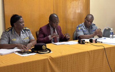
Zimbabwe Surveyor-General Edwin Guvaza said the initiative seeks to make the border visible and eliminate uncertainty for communities that depend on the lake for their livelihoods.
“We have been working on this project since 2021 and expect to complete it by 2027. These two nations are separated only by water, so clarity is critical. The objective is to ensure that the boundary is seen, not guessed,” Guvaza said.
His Zambian counterpart, Surveyor-General Calvin Chibangula, said unclear border lines have historically exposed fishers and boat crews to arrests and conflicts after inadvertently crossing into the neighbouring country’s waters.
“Unclear boundaries have confused our people. Once these markers are in place, communities will be able to fish and conduct business with greater confidence without fear of crossing the border unintentionally,” Chibangula said.
Traditional leaders from both sides of the lake, including Chiefs Mola, Musambakaruma, Negande, and Nebiri, attended the workshop and welcomed the initiative, saying it would improve relations among communities that share the lake’s resources.
In an interview, Guvaza said the two countries also agreed on Standard Operating Procedures (SOPs) to guide movement and activities along the boundary.
“This is a joint exercise between the Surveyor-General of Zimbabwe and Zambia. The SOPs will be submitted to the relevant authorities in both countries for legal adoption and implementation,” he said.
Guvaza added that procedures were developed through consultations held in Kariba and Siavonga, Zambia, and are intended to reduce disputes while promoting sustainable management of shared resources.
“The aim is to ensure communities that depend on the Zambezi River and Lake Kariba can carry out their activities without fear of conflict while protecting shared resources for mutual benefit,” he said.
The international boundary on Lake Kariba was first defined in 1963, but until now, it has remained largely invisible on the water, creating challenges for local communities, tourism operators, and law enforcement agencies.
Lake Kariba, one of the world’s largest artificial lakes by volume, covers approximately 5,500 square kilometres and stretches about 280 kilometres in length along the Zimbabwe–Zambia border.
The lake supports thousands of livelihoods through fishing, tourism, transport, and hydroelectric power generation. It is also home to the Kariba Dam, which supplies electricity to both countries and remains a strategic infrastructure asset in Southern Africa.
The lake forms part of the Zambezi River system, Africa’s fourth-longest river after the Nile, Congo, and Niger rivers. The Zambezi Basin is shared by eight countries and is a critical source of water, energy, food security, and economic activity for millions of people across the region.